Maps: windows into the history of our homes, streets, towns and suburbs
In 2024 Queensland celebrates the bicentenary of the foundation of the first European settlement at Moreton Bay. How has this unlikely colony developed into the thriving city of Brisbane, now the context of our lives? Maps are a great way of seeing how a city or locality changes over time. You can access a significant collection of real estate maps on data.qld.gov.au.The maps can be searched online by estate name.
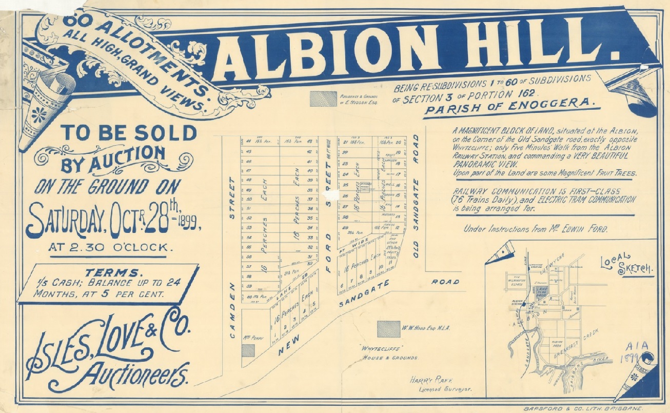 |
Albion Hill [Estate] being re-subdivisions 1 to 60, of subdivision of section 3 of portion 162, Parish of Enoggera / Isles, Love & Co., Auctioneers ; Harry Raff, Surveyor. 1899 State Library of Queensland Picture URL: https://collections.slq. qld.gov.au/viewer/IE423795 |
The map above shows suburban land sales at what is now a busy Clayfield intersection. As a sales notice, it also tells us what features the sellers of the time believed land buyers desired, namely, convenience, including closeness to public transport, a high position and ‘grand views’. Adding to the attractive offer were terms of a 20% deposit and the debt fully repaid within two years! Old Sandgate Road would later become Bonney Avenue when Old Sandgate Road was split by the new railway line.
The notice also provides important detail for tracing the area’s history. The land is described as re-subdivisions 1-60 of section 3 of portion 162, Enoggera Parish. This description leads us to other maps at Lands Mapping and Surveying historical maps and plans: Historical cadastral maps series - Queensland, also accessible via data.qld.gov.au in a similar format and with a familiar entry point.
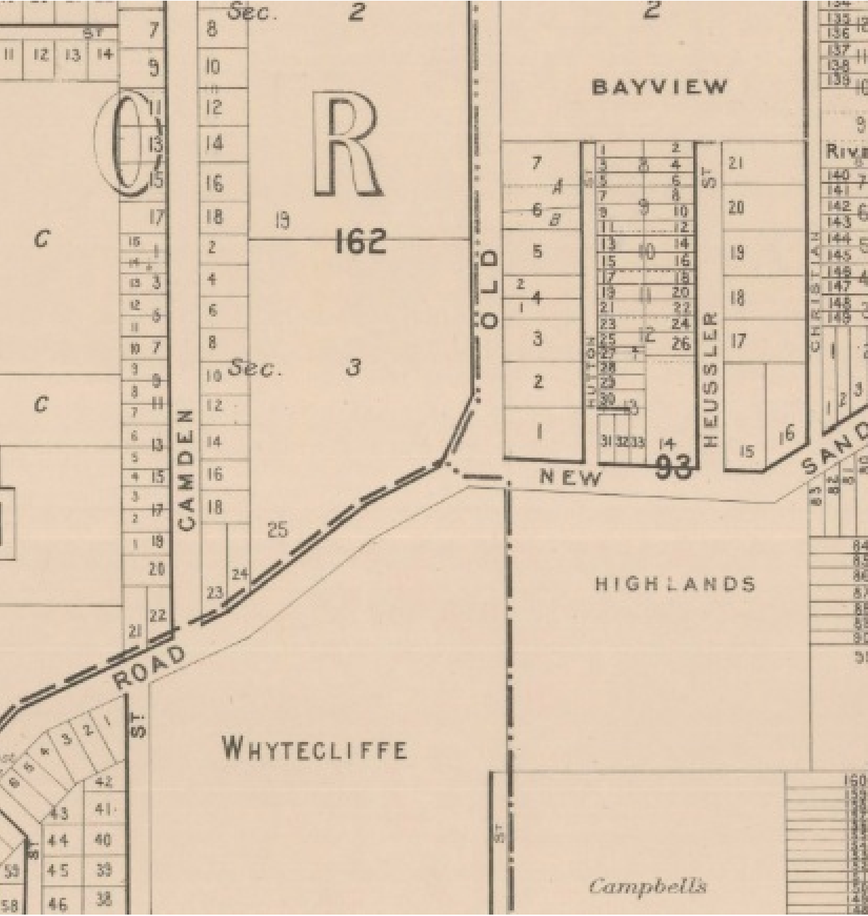
McKellar’s official map of Brisbane and suburbs 1895
McKellar’s 1895 map shows us the land 4 years earlier when the blocks along Old Sandgate Road, on the left side from New Sandgate Road, had not been subdivided but are indicated only as portion 162. Much of the surrounding land was still in large estates.
|
McKellar’s official map of Brisbane and suburbs sheet 2 1895 original (10767×7887) (information.qld.gov.au) |
Who originally bought the land from the Crown?
First ownership can be traced, once again, using Historical cadastral maps series - Queensland and checking 40 chain AG2 series 1887–1932—Moreton district. Within the options listed is a map from 1919 - sheet one, which shows us that the first owner of portion 162 was J L Zillman who purchased it in 1858.
Johann (later John) Leopold Zillman, of the Moravian missionaries, was among the first free European settlers in 1838 in what became Queensland. Zillman eventually became a pioneer farmer and bought significant land.
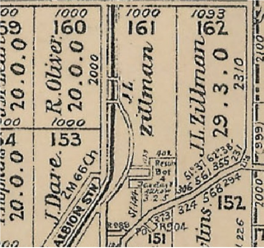 |
40 chain AG2 series 1887–1932—Moreton district 1919 |
Using open data maps, it is possible to get a broad overview of how Crown land moved from the first deed of grant, in this case belonging to J L Zillman, through the various stages of development leading to the suburban subdivisions in Clayfield which we are familiar with today. Explore these links and those to other maps to see how our homes and suburban landmarks took on their current shape and character and how our communities developed over time.